Ecoregions of Saskatchewan
An ecoregion is relatively large area of land that contains a geographically distinct pattern of recurring ecosystems. Each ecoregion is associated with a particular combination of soil types, landforms, and plant and animal species. Each ecoregion has a name, which is in general inspired by the dominant features of the ecoregion. There are 11 ecoregions in Saskatchewan.
Ecoregion descriptions and maps based on material developed by Environment Canada. © Her Majesty The Queen in Right of Canada, as represented by Environment Canada, 2008. reproduced with the permission of the minister of public works and government services canada.
Note: The maps below open in a new window.
|
|
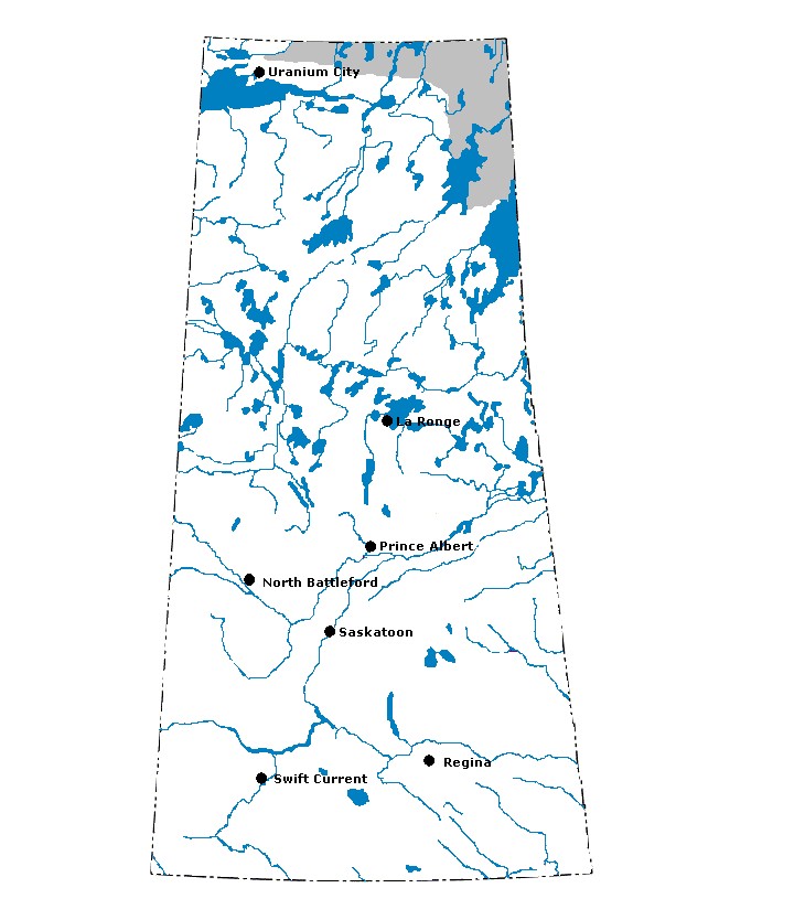
Selwyn Lake Upland: Selwyn Lake Upland: The Selwyn Lake Upland is found in northern Saskatchewan. This area has Precambrian rocks that form a broad and sloping upland. In some places, the soil stays frozen all year. There are sandy ridges, bedrock outcrops, and lakes in this ecoregion. Because of the cool temperatures and low rainfall, the trees are shorter and the forests more open than in other ecoregions in the province. Black spruce is very common in the Selwyn Lake Upland.
|
|
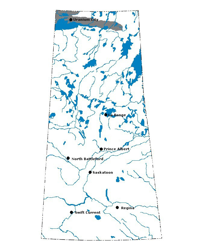
Tazin Lake Upland: Tazin Lake Upland: This rugged ecoregion is north of Lake Athabasca. In low-lying areas, black spruce trees are found on soil that is frozen year-round. The rocks are treeless, while black spruce and jack pine are found on sandy lower slopes. White spruce can be found in valleys and on the shorelines of the many small lakes and streams.
|
|
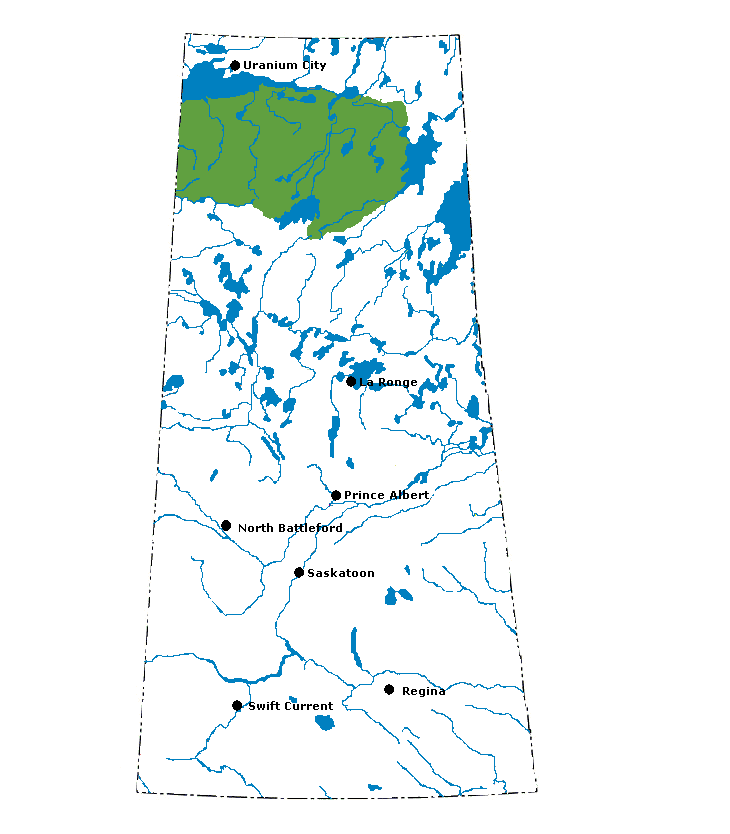
Athabasca Plain: The Athabasca Plains most amazing feature is the large sand dune on the south side of Lake Athabasca. This ecoregion is flatter than the Tazin Lake Upland and has fewer lakes; forest fires are frequent. Jack pine, spruce, and birch trees are common in the Athabasca Plain. It is also home to several plants — such as Turnors willow, sand chickweed, and Mackenzie hair-grass — that are found nowhere else in the world.
|
|
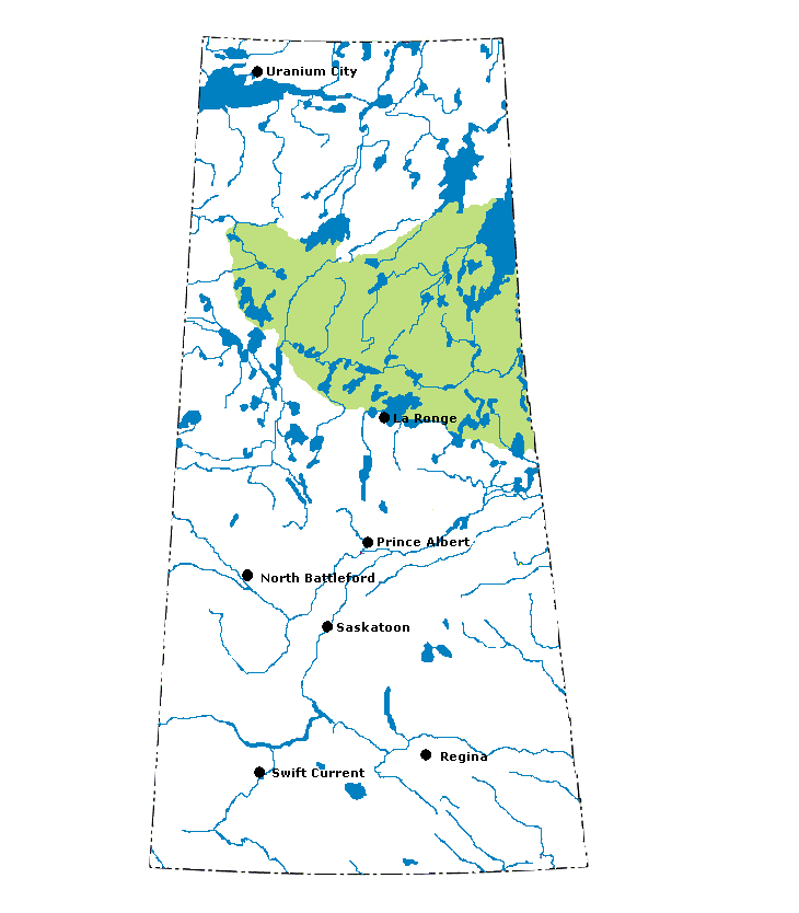
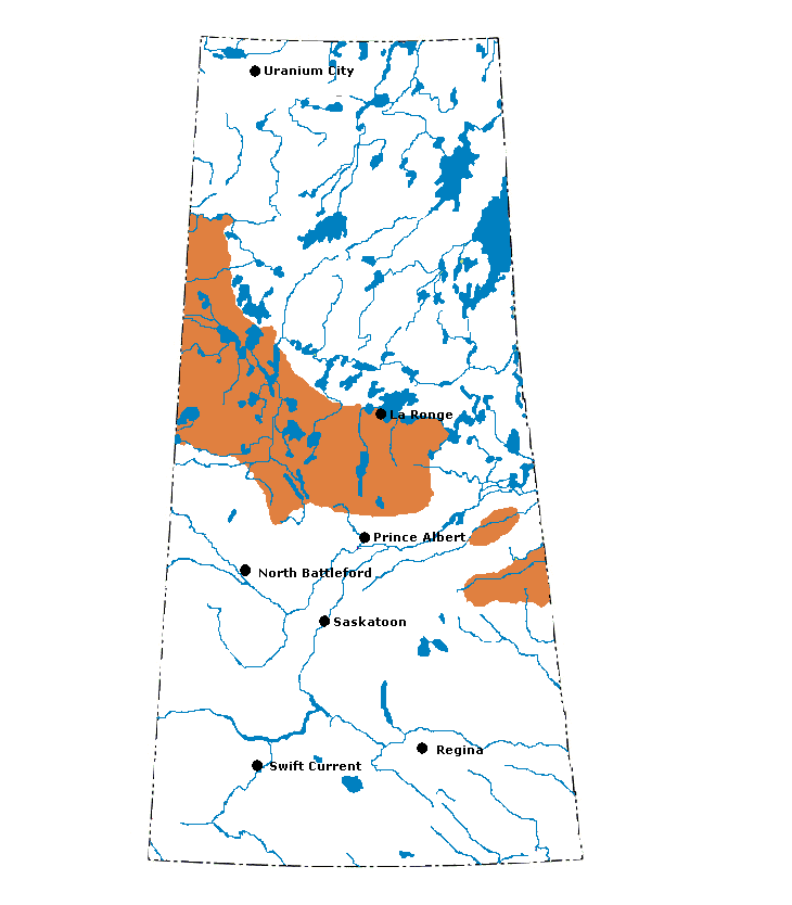
Churchill River Upland: Almost 40% of the Churchill River Upland is covered in lakes and rivers. The lakes are long and narrow and are situated in the direction of glacial ice movement. Sandy soils with low stands of jack pine and black spruce are common, though there are clay soils with white spruce and aspen scattered throughout the ecoregion. Frozen peatlands in this region are home to black spruce and tamarack.
|
|
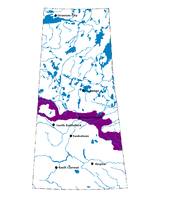
Mid-Boreal Upland: The Mid-Boreal Upland has many different landforms. The soils are mostly loamy gray, though some poorly drained sandy soils are also found. Aspen and white spruce are common in this ecoregion. Jack pine is found in sandy areas and is mixed with black spruce in upland areas. Tamarack and black spruce are found in the common low-lying, treed peatlands.
|
|
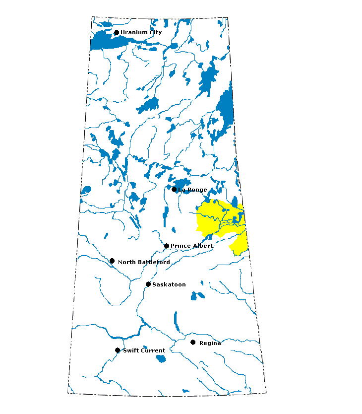
Mid-Boreal Lowland: The Mid-Boreal Lowland is a flat, low-lying region with an abundance of wetlands located in east central Saskatchewan. This area contains some of the most productive forest land in the province. Common trees in the area include white spruce, balsam fir, aspen, American elm, green ash, and Manitoba maple.
|
|
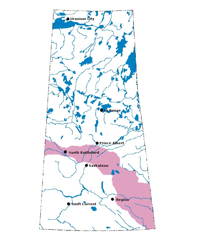
Boreal Transition: Boreal Transition: This ecoregion is at the boundary between forest to the north and farm land to the south. Farming is common on the lowlands and plains in this area because the soil is fertile. In hilly upland areas, aspen is common. Other common tree species include white spruce and jack pine.
|
|
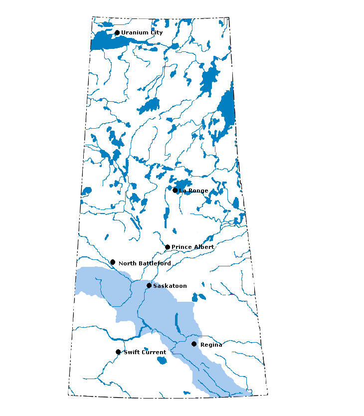
Aspen Parkland: The majority of this ecoregion in Saskatchewan is farmed. In its natural state, it consists of aspen and fescue grassland. The Aspen Parkland is dotted with lakes and sloughs created by the movement of glaciers through the area.
|
|
Moist Mixed Grassland: This ecoregion is dominated by agriculture. Native plants are found only where the land is not suitable for farming. They include wheatgrass, chokecherry, snowberry, rose, and wolf willow.
|
|
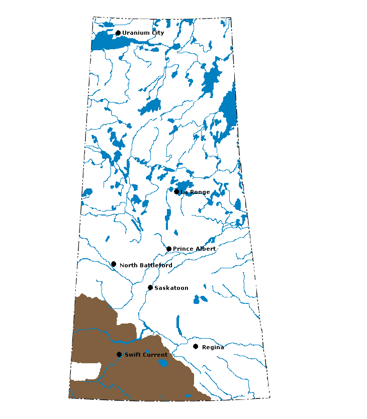
Mixed Grassland: The Mixed Grassland is the driest ecoregion in Saskatchewan. There are few lakes or sloughs in this area. The landscapes include glacial lake plains, sand dunes, badlands, and the hilly pothole terrain known as the Missouri Coteau. Common plants are wheatgrass, speargrass, and occasionally blue grama grass. Common shrubs include snowberry and wolf willow.
|
|
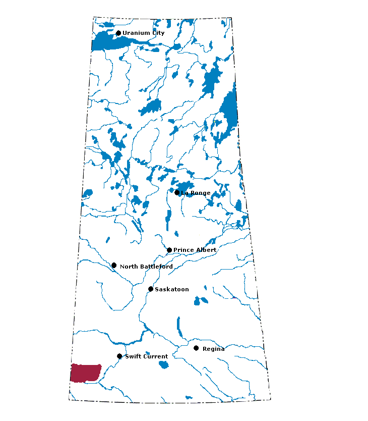
Cypress Upland: This unique ecoregion rises 500 metres above the surrounding plains. At the base of the upland, brown soils and grassland are found, while a sub-montane fescue prairie occurs on the south facing slopes. Lodgepole pine, white spruce, and aspen are found on the upper slopes. Lodgepole pine is not found in any other ecoregion in Saskatchewan. Steep hills, lakes, and streams are characteristic landscape features of the Cypress Upland.
|
